McPhee's Saskatchewan, 2nd edition
The independently published 10-in-1 wall map that shows prairie history at a glance
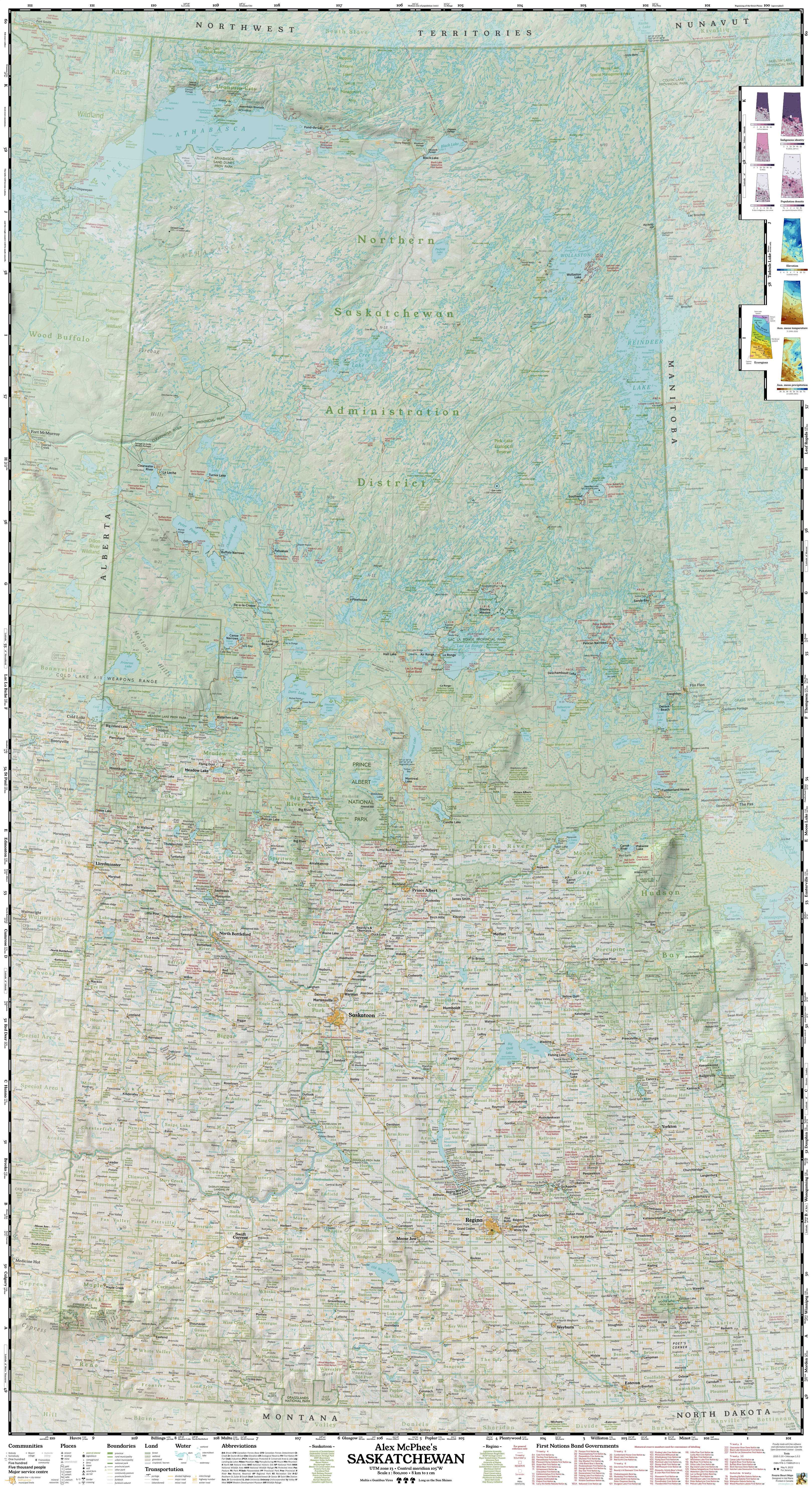
McPhee's Saskatchewan
This comprehensive historical map has everything from Abbey to Zenon Park. Published right here in Val Marie. Over 2,000 sold!
All three options are the same size and show nearly the same content. Art prints use a premium satin photo stock and more vibrant inks.
An independently published wall map?
As seen on
Check out my cable TV special! (10:06)
My very first job was in a pioneer museum, where I would constantly get questions about long-gone railway towns. I assumed there must be some map out there that would show them all. Wrong!
After about 1,000 hours of data collection and manual drafting, I made it myself. The final result is a large 36" x 66" product, showing more detail than any other provincial map published in the 21st century. Hanging it on your wall will make you want to get lost.
I design and publish my work in Val Marie, Saskatchewan. In a mapping industry dominated by phone apps and American tech giants, my mission is to bring prairie stories home.
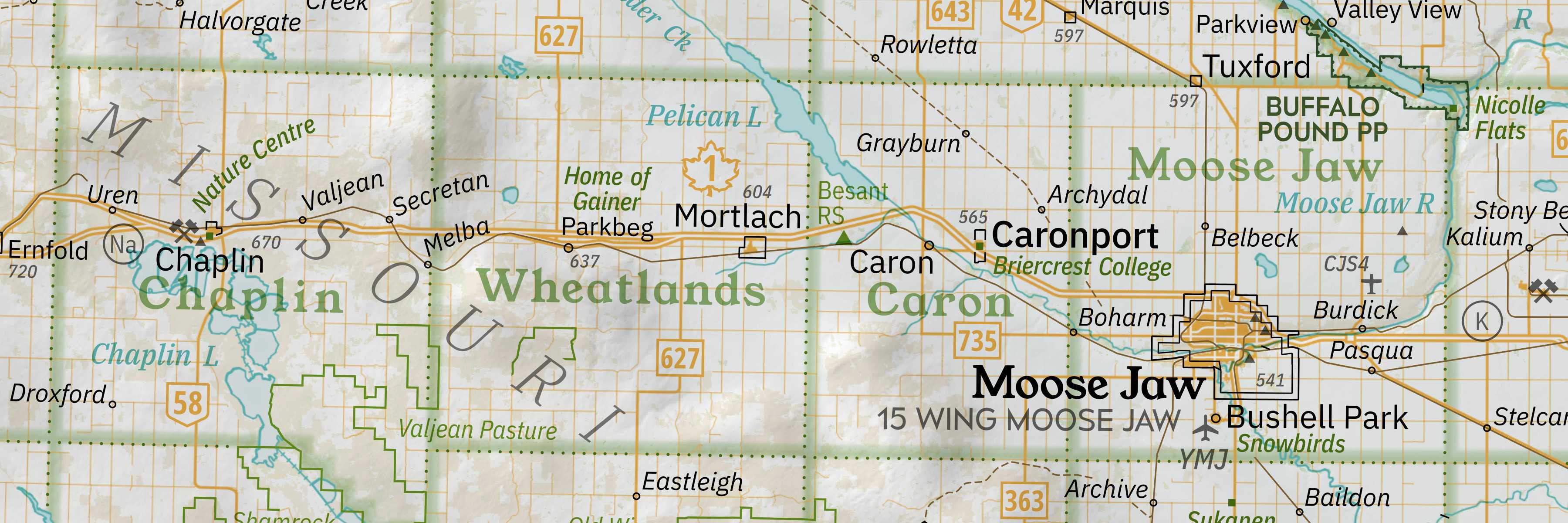
Saskatchewan's majestic glacial landscapes aren't really all that flat. See their rise and fall illuminated in dramatic 3-D by my own in-house relief-shading algorithm.
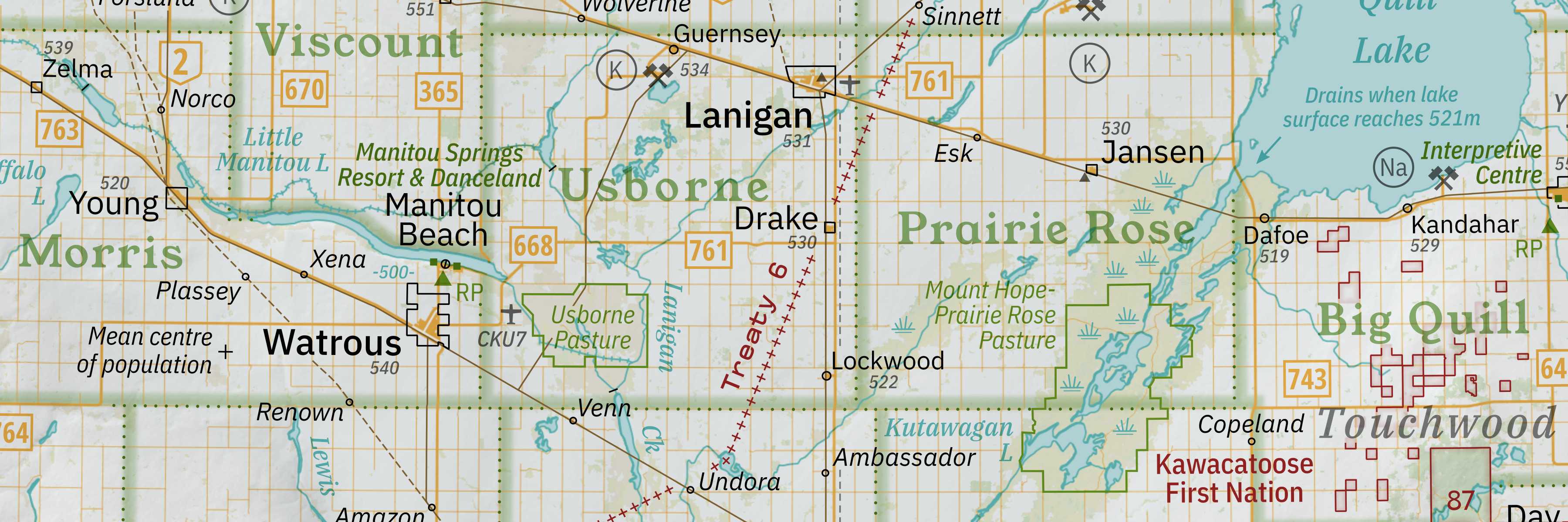
It's all about the details, and you'll find plenty in my work. Not commonly seen on other maps: Treaty boundaries, irrigation canals, airfields, the flooded Quill Lakes, community pastures... and even the province's mean centre of population (accurate to 2021).
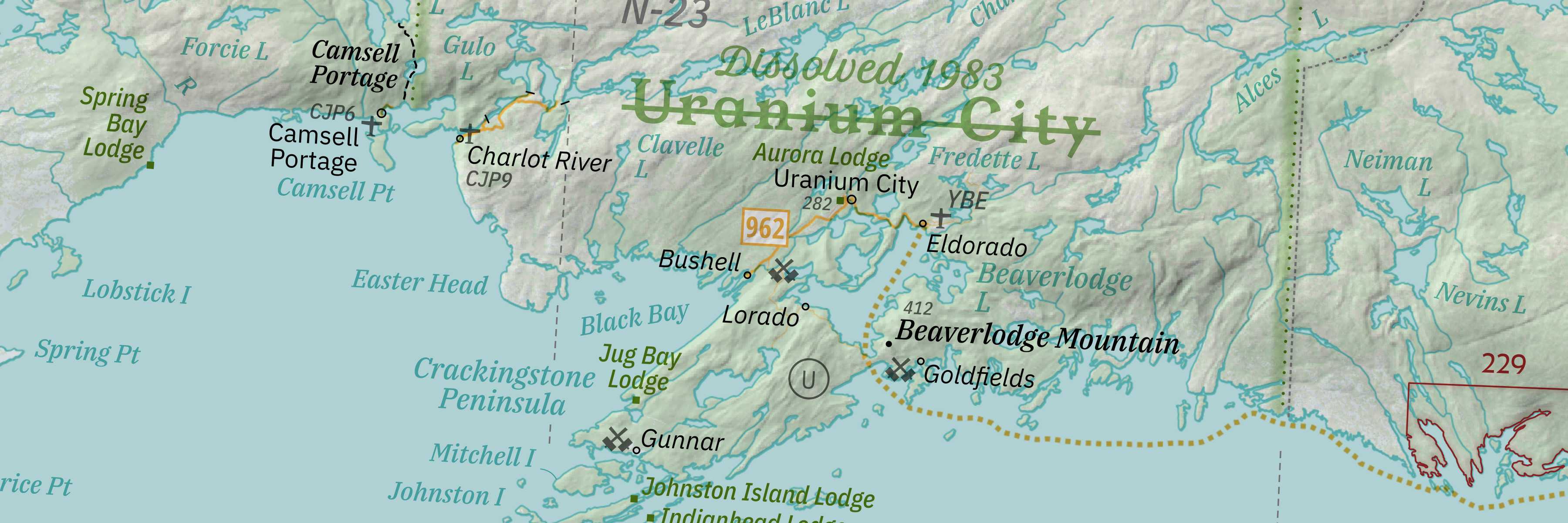
Don't forget the other half of the province! No existing dataset was good enough to properly illustrate the complex Canadian Shield: every creek on the map is traced by hand. Explore the great North with a comprehensive listing of mines, lodges, and lands.
Second Edition
You asked for it - my first printing sold out in its first year! Twelve months after release, I added the public's most-requested feature, fixed a handful of embarrassing mistakes, and created a 10-in-1 Second Edition with all-new insets expounding upon Saskatchewan's population, climate, and landscape.
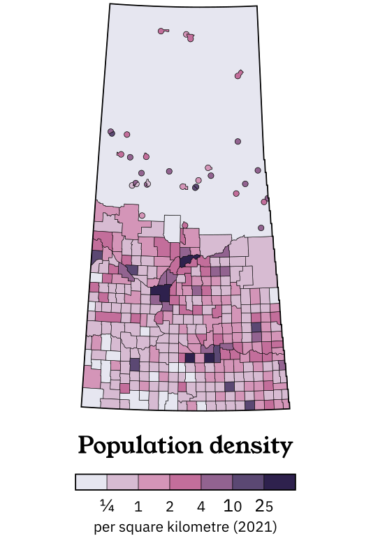
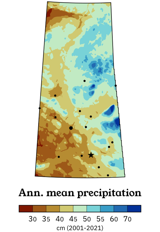
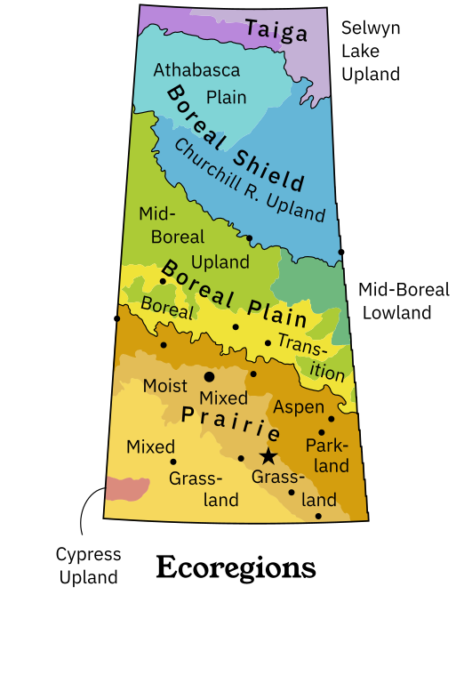
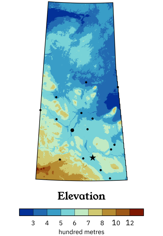
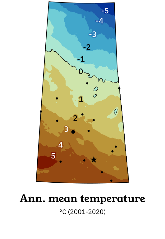
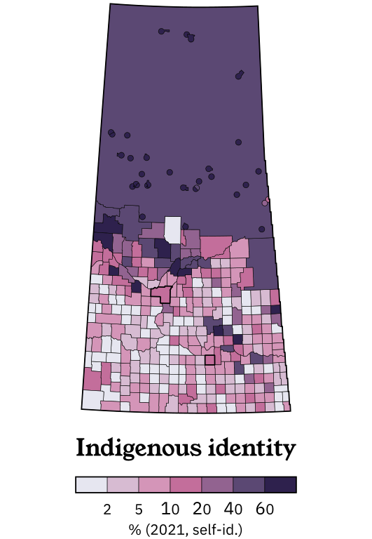
I've always loved browsing old school atlases, and this Second Edition exclusive feature is inspired by traditional print. These colourful insets cover a variety of interesting topics that just wouldn't fit into the rest of the map, selected for educational value and curriculum compatibility.